
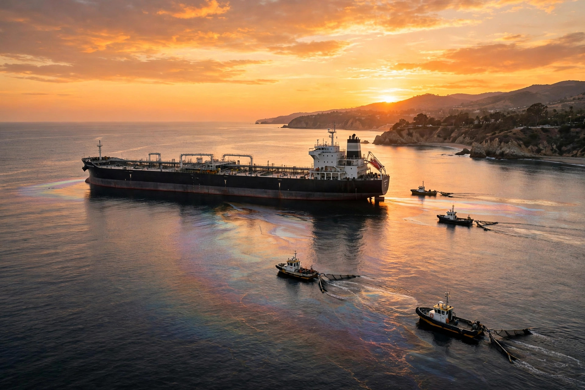
The UAE oil leak Gem No 2 tanker update given on Friday, 30 October 2026 brought the first clear improvement in a spill that had raised concern along the northern coast of the United Arab Emirates. The UAE said on that day that the oil leak from the Gem No. 2 tanker, also written GEM NO. 2, had been stopped, with no new leakage detected, as cleanup continued. That statement did not mean the incident was over: the oil already released still had to be dealt with, beaches and coastal areas had been closed temporarily as a precaution, and technical teams were still working on the tanker itself. It did mean, however, that the source of the leak had been brought under control, and that the authorities could focus on cleaning up what was already in the water and on deciding the safest way to handle the vessel. This article explains the UAE oil leak Gem No 2 tanker update in full: where the slick is, what the latest satellite imagery shows, how the cleanup is being carried out, what is known about how the leak started, and what is still not known.
What the UAE oil leak Gem No 2 tanker update says
The central fact in the UAE oil leak Gem No 2 tanker update is straightforward. The UAE said on Friday, 30 October 2026 that the oil leak from the Gem No. 2 tanker had been stopped, with no new leakage detected, as cleanup continued. The words "no new leakage detected" are important, because they describe the position at that point in time: the leak had stopped and, at the time of the update, no fresh oil was being found leaking from the vessel. That is a statement about the leak itself, not a claim that all the oil already in the sea had been removed. The oil slick is concentrated off the northern emirate of Umm Al Quwain, and it extends partly towards coastal areas in Ras Al Khaimah, Ajman and Sharjah. Those four emirates are all on the northern coast, so the slick is concentrated in one area but reaches partly towards the coasts of three neighbouring emirates as well. The density and concentration of marine pollution has declined markedly, and in the ministry's wording significantly, according to the Ministry of Climate Change and Environment, based on satellite imagery as of Friday, 30 October 2026. Satellite imagery is used here as the basis for that assessment: it is the ministry's reading of images taken from above, showing how much pollution is visible and how dense it is, rather than a figure drawn from a single sample in the water. The assessment is dated to Friday, 30 October 2026, which is the same day as the update that the leak had been stopped.
The update also addressed the closures that had been put in place along the coast. Authorities have temporarily closed some beaches and coastal areas as a precaution. The ministry said this did not necessarily mean pollution had been detected at every site affected by the closures. That distinction is worth understanding, because a precautionary closure is a preventive step: an area can be closed while checks are carried out, even if pollution has not been found there. The ministry's point was that the list of closed sites should not be read as a list of polluted sites. Some beaches and coastal areas were closed temporarily as a precaution, while the density of marine pollution, according to the ministry's satellite imagery assessment, had declined markedly. The two facts sit together: the closures were precautionary, and the overall picture of pollution in the sea was improving, according to the ministry. The update did not give a figure for the volume of oil released, and no such figure is given in this article, because none was included in the verified facts for this update.
Where the slick is and why pollution is declining
The slick is concentrated off the northern emirate of Umm Al Quwain, and it extends partly towards coastal areas in Ras Al Khaimah, Ajman and Sharjah. Umm Al Quwain is the emirate off whose coast the slick is concentrated, and the other three emirates are the ones towards whose coastal areas it extends partly. That geography matters for the cleanup, because the work has to cover the main concentration off Umm Al Quwain and also the areas towards which the slick extends. The ministry's assessment, based on satellite imagery as of Friday, 30 October 2026, was that the density and concentration of marine pollution had declined markedly, or significantly in the ministry's wording. A decline in density does not mean the slick has disappeared, and it does not mean the cleanup is finished. It means that, in the ministry's reading of the satellite imagery, the pollution was less dense and less concentrated than it had been. That improvement is consistent with the other part of the update: the leak had been stopped, with no new leakage detected, so no fresh oil was being added to the slick while the cleanup continued. When a leak stops, the oil already in the water can be worked on without the task growing, and that is the position the authorities described on 30 October 2026. The cleanup itself, which is described in the next section, is the work that turns a stopped leak and a declining density into a cleaned-up coastline.
The coastal closures should be understood in the same light. Authorities have temporarily closed some beaches and coastal areas as a precaution, and the ministry said this did not necessarily mean pollution had been detected at every site affected by the closures. A temporary closure is a way of keeping people away from an area while it is checked and cleaned, and it can be put in place before pollution is confirmed at that particular site. The ministry's clarification was therefore a caution against reading too much into the closures: they show where precautions were taken, not necessarily where pollution was found. That is a common pattern in a marine pollution incident, where the authorities close areas that could be affected, monitor them, and reopen them when they are satisfied. No reopening date was given in the verified facts, and none is claimed here.
How cleanup is being carried out
The cleanup is being carried out by environment ministry teams in coordination with federal and local authorities and with NCEMA, through field surveys, monitoring and cleanup. Field surveys mean teams going out to look at the affected areas directly, monitoring means keeping watch on how the slick and the pollution change over time, and cleanup is the work of removing the oil. The methods used are primarily mechanical recovery methods, plus chemical dispersants, in accordance with international standards. Mechanical recovery is the physical removal of oil from the water, and chemical dispersants are substances used to help break up oil so that it disperses. The verified facts say the methods are primarily mechanical recovery plus chemical dispersants in accordance with international standards, and that is the description used here, without adding detail about specific equipment or quantities that was not in the verified facts. The coordination described in the update matters as well: the environment ministry teams are working in coordination with federal and local authorities and NCEMA, which means the response involves more than one level of government and NCEMA, rather than a single team working alone.
Work is also continuing on the tanker itself. Technical teams have repaired damaged parts of the tanker, restored some operating systems, and are assessing the integrity of its structure to determine the safest way to handle it. That sentence describes three separate stages of work on the vessel: repairs to damaged parts, restoration of some of its operating systems, and an assessment of the structure. The assessment is to determine the safest way to handle the tanker, which means the authorities have not yet decided, or at least have not announced, the final plan for the vessel. The repairs and the restoration of some systems are steps that have already been taken, while the assessment of structural integrity is the work that will inform what happens next. The vessel is the Gem No. 2, also written GEM NO. 2, and its IMO number is 9735373, according to the report cited below. All 22 crew members were rescued. That figure, 22 crew members, is the number given in the verified facts, and it is stated here as a fact about the rescue, not as part of the leak update itself.
What caused the leak? What is known and what is not
The question of what caused the leak is the part of the story where attribution matters most, and where the verified facts are careful about what is and is not known. Shipping sources told Reuters that the vessel was struck by a projectile on 9 October, causing a fire that was later extinguished. That account is attributed to shipping sources speaking to Reuters, and the date given in that account is 9 October. The fire, according to that account, was later extinguished. Authorities have NOT said what caused the spill. That is a clear and important limit: the official authorities have not stated a cause. The party responsible has not been officially identified. Those two points should be kept together, because they prevent a reader from treating an attributed report as an official finding. The report from shipping sources is one account, given to Reuters, and the official position is that no cause has been stated and no party responsible has been officially identified. According to IranianUAE, the vessel was struck about 13 nautical miles west of Al Jazirah in Ras Al Khaimah. That location, about 13 nautical miles west of Al Jazirah in Ras Al Khaimah, is the location given in that report, and it is presented here with that attribution. The vessel's IMO number is 9735373, and all 22 crew members were rescued, as stated in the same account.
There is also a wider context that Reuters reported, and it should be presented with its attribution and not as a cause of this incident. In Reuters' context, since the start of the US-Israeli war with Iran, attacks on commercial vessels in Gulf shipping lanes have driven up security risks. That is Reuters' context for the wider situation in Gulf shipping lanes, and it is attributed to Reuters here. It is not presented as the cause of the Gem No. 2 incident, because the cause of this incident has not been officially stated, and the party responsible has not been officially identified. The distinction between a general context about shipping risks and a specific cause for a specific vessel is essential to an accurate account. The Gulf has seen other shipping and energy incidents in October 2026, including tankers on fire in the Strait of Hormuz in October 2026, the Ras Tanura refinery attack in 2026, and the Houthi attack on Riyadh airport and a Saudi oil pipeline on 26 October 2026, and there have been US warnings about Gulf and Iran strikes after the midterms. Those are separate incidents and separate stories, and they are linked here only as related reading on Gulf shipping and energy security, not as evidence about what happened to the Gem No. 2.
What happens next in the UAE oil leak Gem No 2 tanker cleanup
What happens next has two parts: the cleanup of the oil already in the sea, and the handling of the tanker itself. The cleanup continues, with field surveys, monitoring and cleanup by environment ministry teams in coordination with federal and local authorities and NCEMA, using primarily mechanical recovery methods plus chemical dispersants in accordance with international standards. The ministry's assessment, based on satellite imagery as of Friday, 30 October 2026, was that the density of marine pollution had declined markedly, which is a sign that the cleanup and the stopped leak are having an effect, but the cleanup is described as continuing, not as complete. The temporary closures of some beaches and coastal areas remain in place as a precaution, and the ministry's point that a closure does not necessarily mean pollution was detected at every site remains relevant while those closures are in force. On the vessel, technical teams have repaired damaged parts, restored some operating systems, and are assessing the integrity of its structure to determine the safest way to handle it. That assessment will decide the next step for the Gem No. 2, and no final plan for the vessel was given in the verified facts. The cause of the spill remains officially unstated, and the party responsible has not been officially identified, so any future official statement on cause or responsibility would be new information, not a confirmation of the attributed report that shipping sources gave to Reuters. For now, the verified position is the one given on Friday, 30 October 2026: the oil leak from the Gem No. 2 tanker had been stopped, with no new leakage detected, the slick is concentrated off Umm Al Quwain and extends partly towards Ras Al Khaimah, Ajman and Sharjah, the density of marine pollution has declined markedly according to the ministry's satellite imagery, and cleanup continues.
Sources: Reuters, WAM, UAE Ministry of Climate Change and Environment, October 2026.