
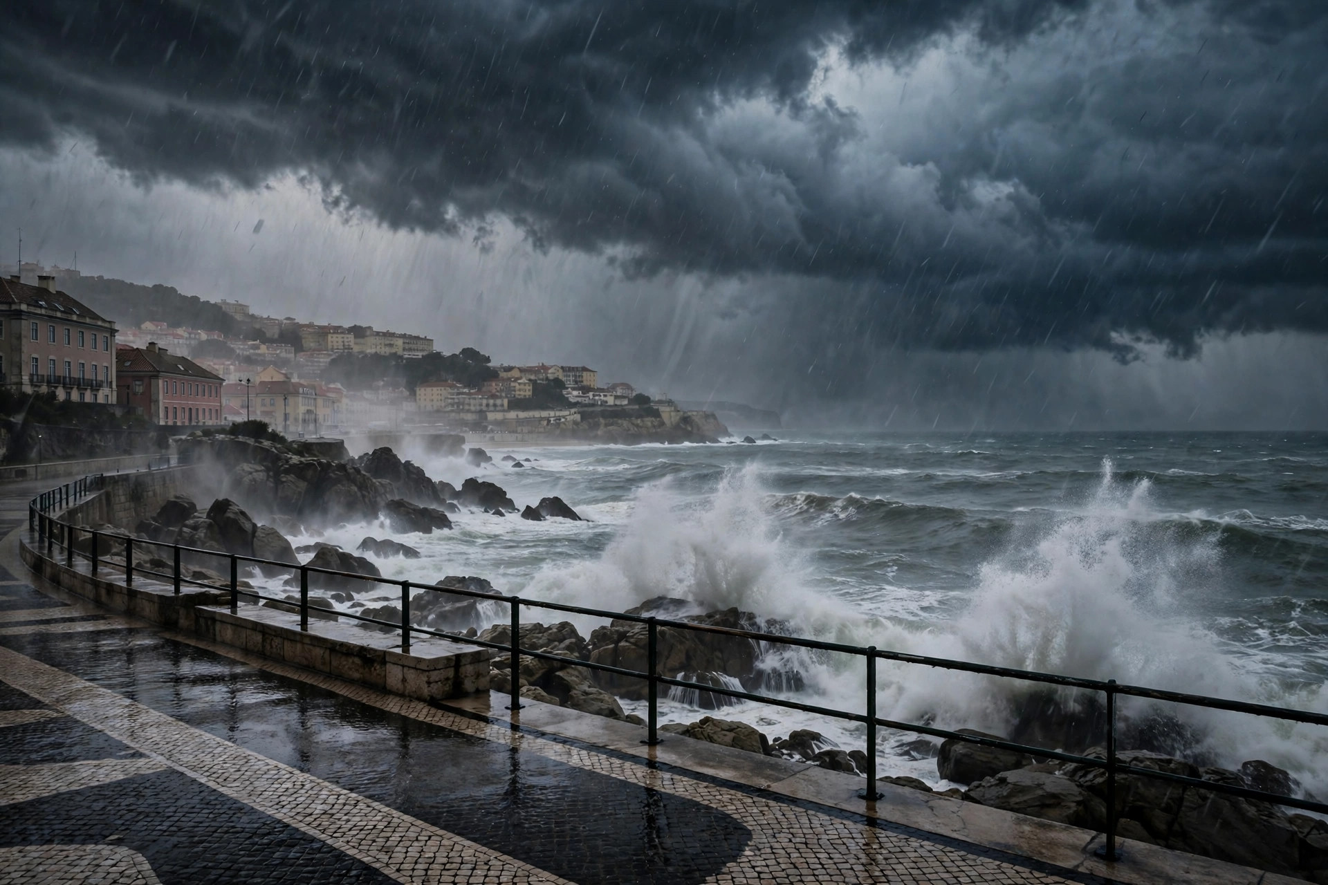
Storm Bruna Portugal is the weather story dominating the Iberian Peninsula this weekend. Named by Portugal's meteorological service, IPMA, on Thursday 5 November, the Atlantic low-pressure system is set to bring its first front to mainland Portugal on the morning of Sunday 8 November 2026, opening a week of heavy rain, strong winds and rough seas that forecasters say could last until Friday 13 November. In mountainous areas, accumulated rainfall could pass 200 millimetres. Madeira is already feeling the system: orange warnings are in force, gusts have been forecast at up to 130 km/h in the highlands, and 37 flights were cancelled at the island's airport on Saturday. This guide explains what Storm Bruna is, where the heaviest rain will fall, which warnings are in force, and what travellers should do.
Storm Bruna Portugal: rain totals and timeline
Bruna is a large low-pressure system centred north of the Azores, and it is not a single passing shower. According to Portugal.fr, which summarised IPMA's forecasts issued on 6 November, the system will send a succession of Atlantic fronts across Portugal, with rain falling intermittently until Friday 13 November and heavier bursts as each front crosses the country. The first significant effects on the mainland are forecast for Sunday morning, when an approaching front brings periods of rain, sometimes heavy and accompanied by thunderstorms.
The headline figure is the rainfall total. IPMA warns that accumulated rainfall could exceed 200 millimetres, particularly in mountainous regions. Portugal.fr notes that this equals 200 litres of water per square metre spread over several days, rather than a single day of rain. The heaviest totals are expected where local geography and the movement of Atlantic fronts favour greater accumulation, and the Lisbon Letter's 7 November briefing put forecast totals at 90 to 120 millimetres in northern and central Portugal, including Minho, Douro Litoral and the Serra da Estrela. Such conditions raise the risk of surface flooding, rapid rises in river levels and local disruption, especially where heavy rain falls over a short period.
One factor behind the intensity is an atmospheric river. Hopinportugal, citing AgroPortal, reports that the intense rainfall expected with this system is driven by its interaction with an atmospheric river on Monday, and that Sunday and Monday, 8 and 9 November, may bring the heavier downpours and stronger coastal winds as the front settles in. Some computer simulations have shown 100 millimetres accumulating in certain regions over the next few days, though those remain scenarios that need confirmation.
Madeira hit first: flights cancelled and trails closed
Madeira felt Bruna before the mainland. The system reached parts of the archipelago on 5 November, and IPMA issued an orange warning for heavy and persistent rainfall between 6 pm on Saturday and 3 am on Sunday, with a separate orange warning for wind on Saturday evening. According to Portugal.fr, rainfall totals in Madeira could exceed 90 millimetres over two days, with wind gusts reaching 110 km/h in some mountainous areas, while the Times of Madeira, citing IPMA, put gusts at 100 km/h in low-lying areas and 130 km/h in the highlands. Waves along the island's southern coast could reach three to four metres on Sunday, and the Times of Madeira reported waves of 3.5 to 4.5 metres possible.
The disruption was immediate. Madeira International Airport had 16 cancelled flights on Saturday morning, and by Saturday afternoon the total had reached 37 cancellations, 20 arrivals and 17 departures, according to ANA Aeroportos data reported by dnoticias.pt. Affected airlines included TAP Air Portugal, easyJet, Transavia, British Airways, Ryanair, Jet2 and Enter Air. Videos of aircraft abandoning landing attempts at Madeira Airport spread online on Saturday, with a Condor aircraft and an easyJet aircraft both performing go-arounds, the manoeuvre pilots use when conditions make a safe landing too risky.
On land, the Instituto das Florestas e Conservacao da Natureza closed all classified hiking trails across Madeira for Sunday 8 November, including the forest road connecting Eira do Serrado to Pico do Areeiro, the island's highest point. The Azores are also being affected by the wider depression: Sao Miguel and Santa Maria, in the eastern group, were under a yellow warning for heavy precipitation on Friday evening.
Storm Bruna Portugal: warnings, wind and waves
On the mainland, warnings were already in place before Bruna's first front arrived. Eight districts, Porto, Braga, Viana do Castelo, Aveiro, Coimbra, Leiria, Lisbon and Setubal, were under yellow warnings for heavy showers and possible thunderstorms from 3 pm on Friday 6 November until midnight. IPMA has indicated that further warnings may be issued as each front approaches, so the warning picture will keep changing through the week.
Wind is the second concern. Portugal.fr reports that southerly winds are expected to strengthen from Sunday, with gusts potentially reaching 70 km/h along Portugal's western coastline and in higher-altitude areas. Hopinportugal puts possible gusts at up to 90 km/h. Along the west coast, south-westerly waves measuring one to two metres on Saturday could increase to four or five metres by Monday 9 November. Conditions in the Algarve are expected to be less severe, although the region will still see stronger swell, with waves of one to 1.5 metres forecast for Sunday, rising to two or three metres on Monday. Exposed beaches, rocky shorelines, harbour walls and coastal promenades could become particularly hazardous as the swell builds.
Spain and the Canary Islands also in Bruna's path
Bruna is an Iberian event, not only a Portuguese one. Spain's meteorological agency, AEMET, expects the most difficult weather between Sunday and Tuesday, with heavy to very heavy rainfall, thunderstorms, strong wind gusts and rough seas. The western part of the peninsula, Galicia, Extremadura and western Andalusia, will be most affected, and AEMET says more than 200 litres of rain per square metre could accumulate over the whole event in the western Sistema Central and in the west and south of Galicia. Spain's Civil Protection agency is maintaining warnings for the Canary Islands and the Iberian Peninsula, and the southern part of Castile and Leon and the northern part of the Madrid region also fall within the zone expected to receive the heaviest rain.
Catalonia will feel Bruna more lightly. According to Beteve and El Nacional, cited by Barna.News, the first frontal line linked to the storm passes north of the region on Friday, with rain expected from Sunday and the highest chance of rain on Monday 9 November. Gusts of up to 90 km/h are possible along the Atlantic coast from Sunday evening through Tuesday, according to El Pais and Portugal Resident. As the storm deepens, milder temperatures are expected to return to Catalonia.
Why the rain will last all week
The reason Storm Bruna Portugal will linger is its structure. Rather than one compact storm racing across the Atlantic, it is a broad depression that keeps generating new disturbances, and each one throws another front at Iberia. Portugal.fr describes successive frontal systems crossing the country until at least 13 November, and the Lisbon Letter's briefing notes that IPMA updates its warnings as each front approaches. That stop-start pattern is why totals build up over days instead of arriving in one burst, and why the risk of flooding grows through the week as soils saturate and rivers rise.
There is also a naming nuance worth knowing. Hopinportugal notes that Bruna is a low-pressure system, or depression, and that authorities may designate it as Storm Bruna if wind criteria are met, or only as Depression Bruna. Either way, the name was assigned by IPMA, and the rain is the main threat regardless of the label. Travellers and residents should follow the warning levels, yellow, orange or red, rather than the name.
What to do if you are travelling
Anyone in the path of Storm Bruna Portugal this week should check the latest IPMA warnings before setting out, and follow guidance from Portugal's civil protection authorities, particularly before travelling through areas exposed to heavy rainfall, strong winds or dangerous sea conditions. In Madeira, the trail closures and airport disruption show how quickly conditions can change, and flights departing Madeira normally fall under EU261 passenger rights whatever the airline, according to Airlate, which tracked the cancellations.
Drivers should expect standing water, reduced visibility and debris on roads, and avoid crossing flooded stretches. Coastal walkers should stay away from exposed promenades and harbour walls as the swell builds to four or five metres on the west coast. Ferry and flight schedules may change at short notice, so rebooking options should be checked with the operator rather than assumed.
What happens next
The immediate question is how Storm Bruna Portugal's first mainland front behaves on Sunday morning, and whether the Monday atmospheric river delivers the heaviest rain as forecast. IPMA will update its warnings front by front, and the heaviest totals are expected to accumulate through to Friday 13 November. By the end of next week, forecasters should have a clearer picture of total rainfall, river levels and any damage, and whether further low-pressure systems follow close behind Bruna. For now, the message from the forecasts is consistent: a lot of rain is coming, it will last for days, and the west of Iberia will take the worst of it. For background on earlier severe weather in the region, see our coverage of Storm Adam in eastern Spain and Storm Austen in southern France, and our guide to Ireland's storm warning system.
Sources: Portugal.fr, Lisbon Letter, Times of Madeira, Hopinportugal, Spanienpress, Barna.News, Airlate, November 2026.