
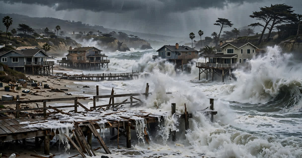
Tropical Storm Rachel has spent three days hammering the Southern California coast — tearing apart a century-old boardwalk, forcing oceanfront evacuations and pushing coastal water levels to near-record highs. As of Monday, October 12, the storm is no longer a tropical cyclone, but its remnants are still flooding communities from the California shoreline deep into the desert Southwest. Here is everything we know, what happens next, and why October storms like this are becoming a bigger part of California's weather story.
What happened: a weekend of battering surf and flooding
Rachel formed in the eastern Pacific earlier in October and tracked north along Baja California before making landfall late Saturday night north of Ensenada, in northern Baja California. By Sunday it had transitioned into a post-tropical system, but that downgrade did not end the danger — its tropical moisture and upper-level spin kept spinning up heavy rain, gusty winds and punishing surf across Southern California through the weekend and into Monday.
The episode prompted the first tropical storm watch issued for any part of Southern California since 2023, when the remnants of Hurricane Hilary moved into the state. This time the threat materialized in a different way: not as a direct wind strike on Los Angeles, but as a one-two punch of coastal flooding from large swells on record-high tides, and flash flooding inland as tropical moisture collided with an approaching cold front.
Long Beach: boardwalk destroyed, homes red-tagged
The worst coastal damage has unfolded in Long Beach, on the city's Alamitos Peninsula. Powerful waves tore through the wooden sections of the historic waterfront boardwalk along Seaside Walk, sending chunks of the century-old structure floating out to sea and driving seawater into nearby homes and streets. By Saturday evening the battered boardwalk had become inaccessible, with officials posting "No trespassing" signs.
Long Beach Mayor Rex Richardson said at least eight buildings covering 13 addresses were red-tagged as unsafe to enter, with one more property yellow-tagged — meaning residents can retrieve belongings but cannot stay until the property is deemed safe. A mandatory evacuation order for oceanfront homes between the 64th and 66th blocks of Seaside Walk, issued Friday evening October 9, remains in effect through noon Tuesday, October 13. Richardson warned residents in an Instagram video: "There'll be a difficult next few days. There'll be impacts not just to the Peninsula but citywide."
Further down the coast, Newport Beach declared a local emergency on Friday as fast-moving floodwater rushed through roadways. Long Beach itself had already declared a local emergency in late September after Hurricane Marie battered the coastline, explicitly citing the developing 2026–27 El Niño weather pattern and the coming winter storm season as threats. Rachel arrived just days into October.
Tides near record levels
One of the most striking features of this storm was how the surf combined with already-elevated water levels. Tidal gauges in San Diego and Los Angeles approached record levels during Saturday morning's high tide, and observed water levels ran as much as 1.5 feet above predictions in some areas, according to the National Hurricane Center. Swells amplified by the ongoing El Niño conditions turned what might have been a nuisance high tide into an event that undercut foundations and swallowed beachfront homes.
The National Weather Service kept coastal flood warnings in effect through 2 p.m. Tuesday for beaches in Los Angeles and Orange counties, warning that damaging flooding was likely along vulnerable south-facing beaches, particularly in Long Beach and Malibu, while other coastal areas faced minor flooding and significant beach erosion. High surf advisories brought breaking waves of 4 to 7 feet, with sets up to 9 feet along parts of Orange County.
Inland flooding, desert deluges and mountain snow
Rachel's reach went far beyond the shore. As remnant moisture streamed north and east, heavy rain triggered flash flooding across the Southwest. San Diego County's higher elevations picked up as much as 4 inches of rain, with Palomar Mountain reporting 3.64 inches and reports of flash flooding and debris flows. In the lower Colorado River Valley, Blythe received 2.8 inches — its wettest storm since 1965, according to a San Francisco Chronicle meteorologist.
The National Weather Service's excessive rainfall outlook placed the Las Vegas metro area under a moderate — level 3 of 4 — risk of flash flooding, with widespread rain totals of 1 to 5 inches expected and locally higher amounts possible across Arizona, Nevada, Utah and Idaho. The Weather Channel advised visitors to cancel national park plans in the Southwest until Wednesday because of the combined threat of flash flooding and thunderstorms.
Where the tropical moisture met colder air from an incoming front, it turned to snow: parts of Wyoming, Montana and Idaho were forecast to see their first significant snow of the season, with some places expecting more than a foot. Strong winds gusting through the desert Southwest raised the risk of tree damage, blowing dust and power outages.
Why is this happening in October?
Tropical cyclones striking Southern California are rare, but October sits inside the eastern Pacific hurricane season, which runs into November. Two factors supercharged Rachel. First, the storm tracked over record-warm ocean water for this time of year, letting it hold together far longer than models initially expected. Second, a powerful El Niño — one that the World Meteorological Organization has warned could rank among the strongest on record — is elevating sea levels and steering storm energy toward the West Coast. The October cold front arriving from the northwest acted as a trigger, squeezing out the moisture like a sponge.
Rachel is not the only major tropical system in the basin right now: Hurricane Simon, a Category 4 monster, has been raking Mexico's Pacific coast at the same time, while the remnants of Hurricane Isaias produced tornadoes elsewhere. Taken together, the systems mark a punishing 2026 hurricane season on both sides of North America.
What happens next
Monday remains an active day: the National Weather Service expected rain, elevated surf and a heightened risk of coastal flooding to linger across Southern California, with the greatest chances of rain overnight into early Monday morning and through the afternoon. A second, colder low-pressure system was forecast to arrive late Sunday into Monday, bringing scattered showers, possible thunderstorms and a sharp cooldown — after more than a week of temperatures in the 90s and triple digits, highs were expected to drop 5 to 15 degrees below average into the upper 60s and 70s.
Coastal flooding could continue through at least Tuesday, with forecasters warning that the Sunday-night-into-Monday combination of stronger swells and high tides would be the most dangerous period for vulnerable shoreline structures. Conditions are expected to improve from midweek, with sunny skies returning and another warm-up after that.
The longer horizon is less reassuring. With a strong El Niño developing and winter storm season ahead, California's coastal managers are bracing for a season of repeated erosion and flooding events. Long Beach's emergency declaration cited exactly this threat weeks before Rachel arrived — a sign that cities are starting to treat tropical-influenced October storms not as freak accidents but as part of the region's changing climate baseline. As climate researchers have documented in our climate change explainer, warmer oceans and shifting storm patterns are the backdrop against which events like Rachel unfold.
How to stay safe
Authorities continue to urge people to stay out of the water at Southern California beaches until surf and flooding subside, and to never drive through flooded roads or around barricades. Residents in evacuated zones should wait for the all-clear before returning. Inland, flash flooding can turn normally dry washes and arroyos into torrents within minutes — if you encounter floodwater, turn around.
Sources
Reporting drawn from Associated Press, New York Post, ABC7 Los Angeles, FOX 11 Los Angeles, The Weather Channel, The Desert Sun, Los Angeles Times, National Weather Service and National Hurricane Center advisories (October 2026).
The wild weather brought fire danger too: the Norte Fire exploded in Orange County amid Santa Ana winds.