
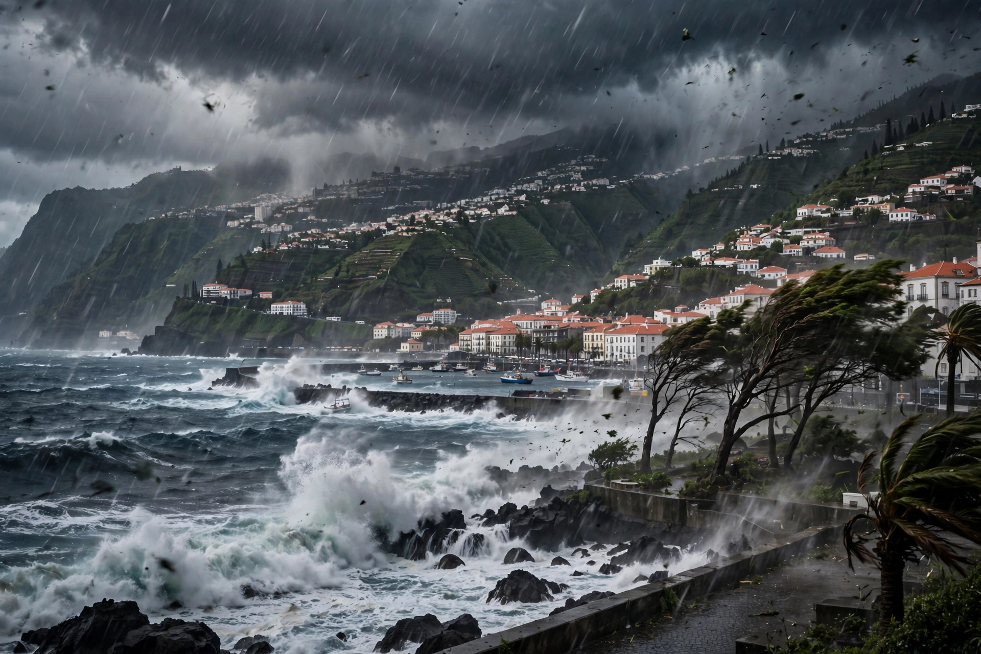
Storm Bruna Madeira has moved from forecast to damage. Depression Bruna, named by Portugal's weather institute IPMA on 5 November 2026, reached Madeira over the weekend of 7 and 8 November, and the island's civil protection service logged a rising count of incidents as trees came down, streets flooded, and roads were blocked. Madeira civil protection logged 125 incidents from 08:00 on Saturday 7 November, a figure given by operations support commander Valter Ferreira when he spoke on Sunday morning, and the count later rose to 145 incidents. At Madeira Airport, 37 flights were cancelled on Saturday alone, and two I Liga football matches were postponed, as the storm disrupted travel and sport as well as daily life.
This article records the impact of the storm on Madeira, not the forecast that came before it. Our earlier forecast piece covered what was expected; this one covers what actually happened on the island, what the counts show at each stage, and what the warnings say about the days ahead. The numbers here are given with their timing, because the incident count changed as the weekend went on: 125 incidents by Sunday morning, then 145 in the later count. Both figures are from Madeira civil protection, and both are reported here as they were given, so that the rise in the count reads as a developing picture rather than a contradiction.
Storm Bruna Madeira: what happened on Saturday
Storm Bruna Madeira reached the island on Saturday 7 November, and the incidents began to build from 08:00 that morning. By 23:00 on Saturday, 111 incidents had been signalled, and the breakdown of that figure shows what the storm did most. Of the 111 incidents signalled by 23:00 on Saturday, 47 were fallen trees, 28 were floods, 16 were road and signage clearances, and 8 were mass movements. Fallen trees were the largest single group, followed by flooding, and the pattern fits a storm that brought strong wind and heavy rain together.
Funchal recorded the most incidents. By 23:00 on Saturday, Funchal had 55 incidents, and that figure later rose to 66. Santa Cruz was next, with 22 incidents by 23:00 on Saturday, later rising to 31. The two municipalities together account for a large share of the island's total, and the rise in both places between the Saturday-night count and the later count shows that reports kept coming in after the worst of the weather had passed. The civil protection total for the island as a whole followed the same path: 125 incidents from 08:00 on Saturday 7 November, as reported by operations support commander Valter Ferreira on Sunday morning, and then 145 incidents in the later count.
Wind, rain and the worst-hit places
The wind and rain figures give a measure of the storm's strength. A gust of 131 km/h was recorded at Chão do Areeiro, and 24.2 mm of rain fell in 60 minutes at Penteada in Funchal. A gust of that speed can bring down trees and signs, and more than 24 mm of rain in a single hour can flood streets and low ground quickly, which matches the breakdown of the incidents: 47 fallen trees and 28 floods among the 111 signalled by 23:00 on Saturday.
One of the floods had a direct human cost. Flooding inundated a house in Santo António da Serra, in Santa Cruz, and forced a family of five from their home. That single incident stands out from the counts of trees and clearances, because it describes people leaving a home rather than a road being closed. The response to the storm was large: 306 operatives and 122 land vehicles were deployed, a deployment that covered the island's municipalities as the incidents spread from Funchal and Santa Cruz to the rest of Madeira.
The disruption spread beyond the streets. At Madeira Airport, 37 flights were cancelled on Saturday alone, a figure that shows how the storm affected travel to and from the island on its busiest day of the weekend. Two I Liga football matches were postponed, which is a smaller detail but a useful one: it shows that the storm's effects reached organised sport as well as transport, and that the authorities chose to call off events rather than run them through the worst of the weather.
Storm Bruna Madeira: warnings and the days ahead
Storm Bruna Madeira was covered by warnings that changed as the storm moved. IPMA had an orange wind warning in force until 00:00 on Sunday 8 November, and then lowered it to yellow. The lowering of the warning does not mean the storm was over. IPMA issued new yellow warnings for Madeira and Porto Santo for Tuesday 10 November to Wednesday 11 November, as conditions worsen again, which means the island faces a second difficult period only a few days after the first.
The system is expected to remain unsettled until Friday 13 November, so the yellow warnings for 10 and 11 November sit inside a longer stretch of poor weather rather than marking its end. For readers on the mainland, the picture is different in timing but similar in risk. Mainland Portugal and Andalusia face the most dangerous window from Sunday 8 November to Tuesday 10 November, with 200 mm or more of rain possible in places, gusts to 90 km/h, and waves of 5 to 6 metres. Our report on that mainland threat, Storm Bruna and the 200 mm rain threat to Portugal, covers the forecast for the mainland in more detail. For a separate weather threat in the same week, see the tropical low bringing flood risk to Central America.
Why the Storm Bruna Madeira impact matters
The Madeira impact matters because it shows how a named depression can disrupt an island quickly. Madeira is a small island with steep ground, a single main airport, and towns built close to the coast and to the valleys that carry water down from the hills. A gust of 131 km/h at Chão do Areeiro and 24.2 mm of rain in 60 minutes at Penteada in Funchal are the kind of figures that translate directly into fallen trees, floods, and blocked roads, and the incident breakdown bears that out: 47 fallen trees, 28 floods, 16 road and signage clearances, and 8 mass movements among the 111 incidents signalled by 23:00 on Saturday.
The count of 145 incidents in the later total, up from 125 on Sunday morning, also matters, because it shows that the full picture took time to emerge. The first count, from 08:00 on Saturday 7 November, gave the scale of the day. The later count, at 145, gave the scale of the weekend. Funchal's rise from 55 incidents by 23:00 on Saturday to 66 later, and Santa Cruz's rise from 22 to 31, show the same pattern at municipal level. The deployment of 306 operatives and 122 land vehicles was the response to that spread, and the 37 flights cancelled at Madeira Airport on Saturday alone show that the storm's reach went beyond the island's roads.
The postponement of two I Liga football matches is a small part of the story, but it is a useful marker of how widely the storm was felt. Matches are not postponed lightly, and the decision to call off two of them on the same weekend as 37 flights were cancelled and a family of five was forced from a flooded home in Santo António da Serra shows that the authorities treated the storm as a serious disruption rather than a routine spell of bad weather.
What happens next
What happens next is a second round of warnings. IPMA has issued new yellow warnings for Madeira and Porto Santo for Tuesday 10 November to Wednesday 11 November, as conditions worsen again, and the system is expected to remain unsettled until Friday 13 November. That means residents and visitors should expect further wind and rain after the weekend's damage, and the incident count may rise again before the system clears.
The mainland picture runs alongside the island's. Mainland Portugal and Andalusia face their most dangerous window from Sunday 8 November to Tuesday 10 November, with 200 mm or more of rain possible in places, gusts to 90 km/h, and waves of 5 to 6 metres. The orange wind warning for Madeira, which was in force until 00:00 on Sunday 8 November before being lowered to yellow, shows how the warning levels moved through the weekend, and the new yellow warnings for 10 and 11 November show that the risk has not passed. Anyone travelling to or from Madeira should check the latest flight information, because 37 flights were cancelled on Saturday alone, and further disruption is possible while the system remains unsettled until Friday 13 November.
Key facts
Depression Bruna was named by Portugal's weather institute IPMA on 5 November 2026. Madeira civil protection logged 125 incidents from 08:00 on Saturday 7 November, a figure given by operations support commander Valter Ferreira speaking on Sunday morning, and the count later rose to 145 incidents. Of 111 incidents signalled by 23:00 on Saturday: 47 fallen trees, 28 floods, 16 road and signage clearances, and 8 mass movements. Funchal recorded the most incidents, 55 by 23:00 on Saturday and later 66, followed by Santa Cruz, 22 and later 31. Flooding inundated a house in Santo António da Serra (Santa Cruz) and forced a family of five from their home. A gust of 131 km/h was recorded at Chão do Areeiro. A total of 24.2 mm of rain fell in 60 minutes at Penteada, Funchal. A total of 306 operatives and 122 land vehicles were deployed. A total of 37 flights were cancelled at Madeira Airport on Saturday alone. Two I Liga football matches were postponed. IPMA had an orange wind warning in force until 00:00 on Sunday 8 November, then lowered it to yellow. IPMA issued new yellow warnings for Madeira and Porto Santo for Tuesday 10 November to Wednesday 11 November as conditions worsen again. Mainland Portugal and Andalusia face the most dangerous window from Sunday 8 November to Tuesday 10 November with 200 mm or more of rain possible in places and gusts to 90 km/h and waves of 5 to 6 metres. The system is expected to remain unsettled until Friday 13 November.
Sources
Madeira Civil Protection via paper.pollar.news; Times of Madeira / DIÁRIO; Webcam Madeira. November 2026.