
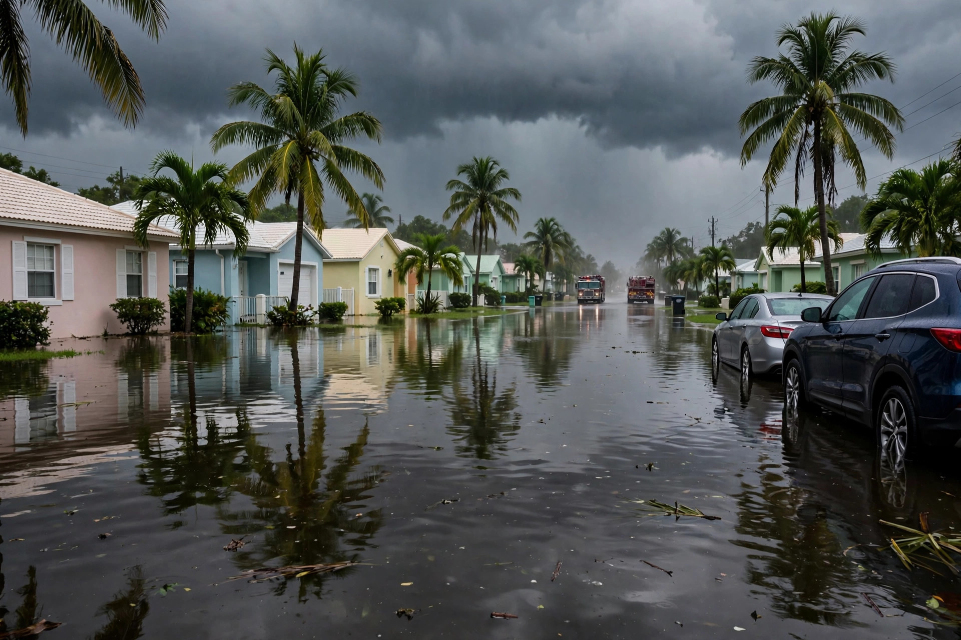
The South Florida floods turned an ordinary November week into one of the wettest stretches the region has seen in decades, after a slow-moving storm dumped about 15 inches of rain in 24 hours on parts of Broward County and pushed a river in central Florida past a flood record that had stood since 1953. Schools closed across two counties, states of emergency were declared in four communities, and a synagogue roof collapsed under the weight of the water — all in the middle of Florida's dry season, when rain like this is not supposed to happen. The rainfall totals are preliminary and vary by gauge, but the picture they paint is consistent: a storm that stalled, dumped, and kept dumping.
How the South Florida Floods Built Up Overnight
The South Florida floods began with rain on the evening of Tuesday 17 November, growing heavier overnight into Wednesday 18 November as a slow-moving storm settled over the region. Slow-moving storms are the dangerous kind in Florida, because the same band of rain keeps passing over the same neighbourhoods instead of moving on. By Wednesday morning, streets across Broward County were under water, cars were stalled in flooded intersections, and emergency managers were declaring states of emergency in Broward County itself and in the cities of Fort Lauderdale, Hollywood and Tamarac. Broward County's declaration took effect on Wednesday 18 November.
The disruption from the South Florida floods spread quickly beyond the roads. Broward and Miami-Dade public schools closed on Thursday 19 November, and Broward schools were also closed on Friday 20 November, while Miami-Dade planned to reopen on Friday. In Hollywood, a synagogue roof collapsed under the rain — no one was hurt, but the collapse showed how much weight the storm was putting on buildings as well as streets. As of Wednesday evening, no deaths had been reported, a fact that officials and residents alike were grateful for given the scale of the flooding. A flood watch remained in place through Friday morning, 20 November, with another 1 to 2 inches of rain possible and some forecasts warning of up to 12 inches in places.
South Florida Floods: The Rain Totals by Area
The National Weather Service's preliminary figures for the South Florida floods put the 24-hour total at 15.3 inches in parts of Broward County. The 48-hour totals were higher still: near Dania Beach, 16.65 inches fell in two days; near Plantation, the figure was 16.38 inches; and west of Lauderhill, 15.37 inches. These are preliminary numbers from official gauges, and they vary from place to place — that is normal in a storm like this, where one neighbourhood can receive several inches more than another a few miles away. One figure from volunteer and home weather stations, 16.91 inches, circulated widely, but it is not an official gauge reading and should not be treated as the headline number.
Fort Lauderdale set a record of its own. The city recorded 5.72 inches in a single downpour ending early on Wednesday, breaking the daily record of 1.8 inches set in 1959. That contrast — nearly three times the old daily record in one burst — captures how unusual this storm was. The Weather Prediction Center also upgraded Brevard County, on Florida's Atlantic coast, to a High Risk of excessive rainfall on Thursday 19 November, the highest category it issues, as the storm's reach extended well beyond South Florida.
A River Breaks a Record Set in 1953
The most striking single measurement of the week came not from a rain gauge but from a river. The St. Johns River near Cocoa reached about 18.1 feet at 8:15am on Thursday, passing the flood of record set in 1953 and the flood produced by Hurricane Irma in 2017. The river's flood stage is 16 feet, so the water stood more than two feet above the level at which flooding begins. A record set in 1953 had survived more than seventy years of Florida weather, including some of the most powerful hurricanes of the modern era — and this November storm, with no hurricane name attached to it, broke it.
That detail of the South Florida floods matters because it shows the storm's reach. The flooding was not confined to the streets of Fort Lauderdale and Hollywood. It pushed rivers in central Florida to levels nobody alive had seen before, and it did so in a week when the calendar said the dry season. The river record is also a warning about what comes next: water that has risen this high takes time to fall, and communities along the St. Johns will be dealing with high water after the rain itself has stopped.
Why It Rained in the Middle of the Dry Season
Florida's dry season runs from October to May, and November is supposed to be one of its drier months. The explanation for the South Florida floods came from National Weather Service meteorologist Alejandra Garcia, who attributed the pattern to El Niño disrupting Florida's usual dry season. El Niño, the warming of Pacific waters that shifts weather patterns around the world, can push extra moisture and storm systems into Florida even in months when the state normally dries out. The result this week was a storm that behaved more like a wet-season system than a November one.
That context helps explain why the South Florida floods caught so many people by surprise. Residents plan their Novembers around dry weather: outdoor work, school schedules, and travel all assume the rain has stopped for the year. A storm that drops 15 inches in a day does not fit that plan, and the school closures and emergency declarations were the practical consequence. The same disruption is likely to linger: Fort Lauderdale is expecting king tides — exceptionally high tides — between 22 and 28 November, which will push extra water into low-lying streets even after the storm has passed.
What Happens Next in South Florida
The immediate question after the South Florida floods is how much more rain falls before the storm clears. The flood watch runs through Friday morning, 20 November, and forecasters are watching for further bands of heavy rain. Broward schools stay closed on Friday while Miami-Dade plans to reopen, a split that reflects how unevenly the rain fell across the two counties. Emergency managers will be watching the St. Johns River as well, since river levels fall far more slowly than street flooding drains away.
Longer term, the South Florida floods are a reminder that Florida's seasons are not as fixed as the calendar suggests. El Niño can rewrite the dry season, and when it does, the consequences arrive fast: closed schools, collapsed roofs, record rivers and streets under water. It has been a week of severe weather worldwide, with Cyclone Akvan gathering in the Bay of Bengal and Cyclone Xavier reaching category 5 near the Cook Islands. The South Florida floods of November 2026 will be measured in inches and feet — 15.3 in a day, 16.65 in two days, 18.1 on the river — but they will be remembered for the timing as much as the totals: a record-breaking flood in the month when Florida is supposed to be dry.