
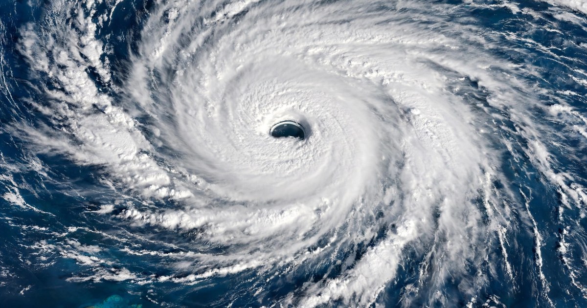
Severe Tropical Cyclone Xavier has strengthened into a Category 5 system over the Northern Cook Islands, the most powerful storm tracked in the region since Cyclone Lola in 2023. The Fiji Meteorological Service, which monitors this part of the Pacific, put Cyclone Xavier's sustained winds at about 215 km/h in its latest bulletin on Wednesday morning, with gusts up to 295 km/h, and the islands of Pukapuka and Nassau are under gale warnings as the storm passes close by. No damage or casualties had been reported as of Wednesday morning, but shelters have been opened across the northern atolls and emergency officials are urging communities to stay on high alert.
Cyclone Xavier: Where the Storm Is Now
In its Special Weather Bulletin No. 26, issued at 05:50 UTC on Wednesday 18 November, the Fiji Meteorological Service placed Severe Tropical Cyclone Xavier near 10.1 degrees south and 163.7 degrees west — about 250 kilometres east-northeast of Pukapuka — at 05:00 UTC. The system was rated Category 5 with a central pressure of 922 hPa, maximum sustained winds of about 215 kilometres per hour near the centre, and gusts up to 295 kilometres per hour.
New Zealand's MetService, which also tracks the storm, gave a similar picture a few hours earlier. At 7am NZDT on Wednesday, it placed Xavier near 9.7 degrees south and 163.6 degrees west, about 280 kilometres northeast of Pukapuka and 300 kilometres north-northwest of Manihiki, with maximum winds of 120 knots — about 220 kilometres per hour. The storm has been moving slowly, tracking west-southwest at about 7 kilometres per hour, and the United States Joint Typhoon Warning Center also lists it as Tropical Cyclone 04P.
On the forecast track, the Fiji service expects Xavier to sit about 240 kilometres east of Pukapuka and about 235 kilometres east-northeast of Nassau by 17:00 UTC on Wednesday, and about 240 kilometres east-northeast of Nassau by 05:00 UTC on Thursday. The next special weather bulletin was due at or before 09:00 UTC on Wednesday.
How Strong Is Cyclone Xavier?
Category 5 is the highest rating on the scale used for tropical cyclones in the South Pacific, reserved for the most destructive systems. Xavier earned it fast. On Monday, the storm was still a Category 1 system, with the United States Embassy in New Zealand warning of gusts up to 130 kilometres per hour by Monday night. Through Tuesday it climbed from Category 2 to Category 3 and then Category 4 — the Cook Islands Meteorological Service put winds near the centre at 165 kilometres per hour, with gusts up to 240 kilometres per hour, at that stage — before reaching Category 5 later on Tuesday.
At its peak on Tuesday, the Fiji Meteorological Service put maximum sustained winds at about 220 kilometres per hour close to the centre, with gusts up to 315 kilometres per hour. That makes Xavier the first Category 5 cyclone monitored by the service's Regional Specialised Meteorological Centre in Nadi since Tropical Cyclone Lola in 2023, which had significant impacts across Vanuatu and the southwestern Pacific.
For readers used to the Atlantic scale, one US-based tropical cyclone analyst put Xavier at the equivalent of a Category 4 hurricane on the Saffir-Simpson scale when its sustained winds were about 235 kilometres per hour, using the US Joint Typhoon Warning Center's one-minute wind estimates. The two scales measure winds differently, so the numbers do not line up exactly — but by any measure, this is a storm at the top end of the scale.
Strength alone does not decide the damage, though. What matters just as much is where the centre goes, how slowly it moves, and how much rain and sea it drags with it. Xavier's centre is not expected to make landfall on any of the affected islands, according to the Fiji service — but forecasters stress that the dangers reach well beyond the centre itself.
Which Cook Islands Are Under Warning for Cyclone Xavier?
Under the latest Fiji bulletin, a gale warning remains in force for Pukapuka and Nassau, a gale alert is in force for Suwarrow, and a strong wind warning is in force for Manihiki and Rakahanga. Communities in the warned areas can expect average winds of up to 85 kilometres per hour, with gusts reaching 120 kilometres per hour, along with heavy rain, squally thunderstorms and rough seas. Coastal flooding is a risk at high tide.
Cook Islands Meteorological Service director Maara Vaiimene told RNZ Pacific that, as of 2pm Cook Islands time on Tuesday, the Category 5 system lay between Pukapuka and Manihiki and Rakahanga, moving west-southwest — passing close to Pukapuka and Nassau while moving away from Manihiki and Rakahanga. The worst of the weather was expected for Pukapuka and Nassau from Tuesday night through Friday morning New Zealand time.
Safety centre shelters have been activated in the Northern Cook Islands, RNZ reported, with communities gathering to shelter together until Cyclone Xavier passes. Emergency Management Cook Islands has urged communities throughout the northern group to remain on high alert, to follow instructions from local disaster teams, to stay in safe shelter and to avoid the coast.
The distances involved show why warnings matter so much here. Nassau is reached by boat from Pukapuka, about 83 kilometres away, and the northern atolls sit hundreds of kilometres from the main island of Rarotonga. When seas turn rough, outside help cannot arrive quickly — so the warning, the shelter and the supplies on hand are what people have to rely on.
Why Cyclone Xavier Strengthened So Fast
Xavier's rise from a Category 1 storm on Monday to a Category 5 by Tuesday is a textbook case of rapid intensification: a storm drawing energy from very warm ocean water in an atmosphere that lets it organise instead of tearing it apart. New Zealand's MetService said the environment around Xavier remains favourable enough to sustain Category 5 intensity for most of Thursday, with maximum sustained winds near the centre of around 120 knots, before the system weakens to a Category 3 or 4 storm from Friday.
Its slow pace helped it grow. Xavier has been crawling along at about 7 kilometres per hour, and the Joint Typhoon Warning Center at one point tracked it moving south at just 3 knots. A slow-moving storm spends longer over the warm water that feeds it, which can keep the strengthening going — and it also means the bad weather lingers longer over the islands in its path.
November has been a busy month for tropical cyclones elsewhere, too. Cyclone Akvan has been building in the Bay of Bengal, with winds expected to reach 145 km/h by 19 November, and Cyclone Arnab made landfall with 150 kmph winds near Yanam earlier in the season. But Xavier stands apart from both: it is the only Category 5 system of the three, and the strongest storm the Nadi centre has tracked in three years.
Manihiki Faces the Storm Without Grid Power
One island's situation stands out. On Manihiki, an atoll in the Northern Cook Islands, families have been facing the Category 5 cyclone while their electricity system has been out of service for more than a year, according to The Cooldown. Households there have been relying on limited solar power and private generators for over a year — which means charging phones, running lights and keeping food cold all depend on equipment that a storm can knock out.
Manihiki is under a strong wind warning rather than a gale warning, and forecasters expect the worst of Xavier to pass Pukapuka and Nassau rather than Manihiki. Even so, heavy rain, strong winds and rough seas are forecast for the atoll, and resident Jean Marie Williams told RNZ about the strain of facing a storm with the island's power already gone.
The risk is not abstract. Flooding is what turns a near-miss into a disaster for low-lying communities, and storm water has already overwhelmed fragile shelter elsewhere this month: a winter storm flooded 70,000 tents in Gaza in November 2026. In the Cook Islands, the defence is preparation — shelters open, supplies stored, and people away from the coast before the worst arrives.
What Happens Next for Cyclone Xavier
Forecasters expect Xavier to hold its Category 5 strength for most of Thursday, then weaken as it moves west-southwest and runs into stronger wind shear — the change in wind speed and direction with height that can tear a cyclone apart. By Friday it is expected to be a Category 3 or 4 system, and to keep weakening into the weekend.
There is no direct cyclone threat to Fiji, according to the Fiji Meteorological Service, and Xavier poses no threat to New Zealand at this stage. Later in the week it may bring rain to Samoa, Niue and the southern Cook Islands. The Cook Islands Meteorological Service and the Nadi centre will keep issuing bulletins as the storm moves, with the next special weather bulletin due on Wednesday.
What happens next depends on the track. If Xavier stays on its forecast path, Pukapuka and Nassau will take the closest pass, with damaging winds, heavy rain and coastal flooding, and the storm will then move away over open water. If it wobbles closer to either atoll, the damage picture changes quickly — which is why the warnings stay in place even though the centre is expected to pass offshore.
The Cook Islands govern themselves in free association with New Zealand, and New Zealand has a constitutional responsibility to respond to Cook Islands requests for disaster assistance. No deployment has been announced for Xavier, and none may be needed if the storm passes without serious damage. For now, the picture is one of a very strong storm, a close pass rather than a direct hit, and island communities waiting it out in shelters. The next bulletins — and the first damage reports from Pukapuka and Nassau — will show whether that is how it ends.