
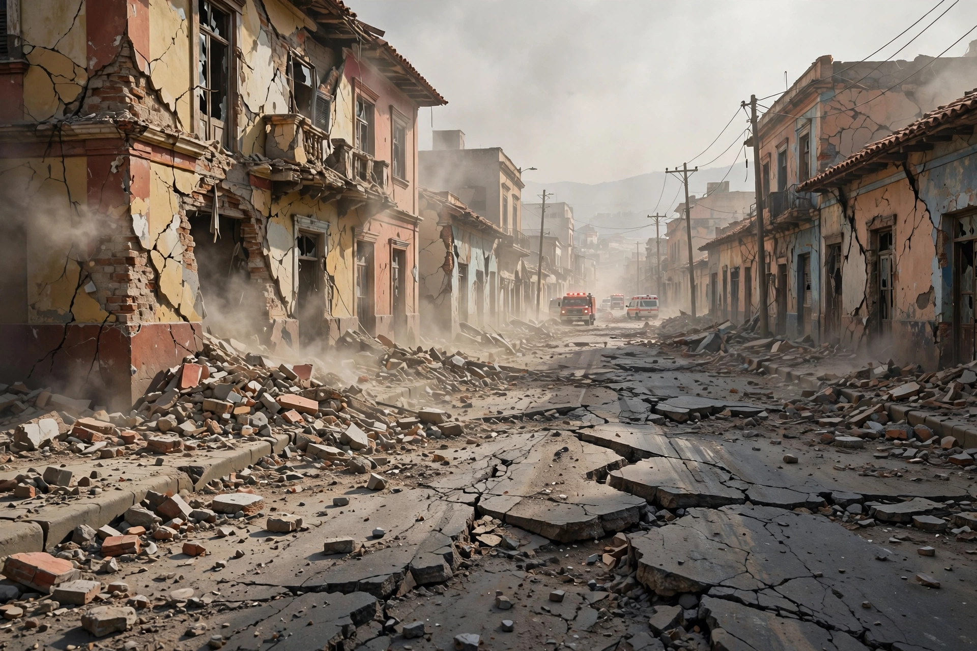
On the afternoon of Friday, 9 October 2026, Panama was hit by two powerful earthquakes in quick succession — a magnitude 7.7 mainshock followed by a magnitude 6.6 quake and a series of aftershocks. Buildings collapsed near the epicenter, residents of Panama City poured into the streets, and a tsunami threat was issued for five countries along the Pacific coast of the Americas. No casualties were reported. Within hours, the tsunami threat was lifted. But the event raised important questions: why is Panama so prone to earthquakes, how do scientists measure them, and how do tsunami warnings actually work?
Why Panama Shakes: Life on the Ring of Fire
Panama sits on the Pacific Ring of Fire, the horseshoe-shaped belt of intense seismic and volcanic activity that rims the Pacific Ocean. The Ring of Fire hosts roughly 90 percent of the world's earthquakes, and the isthmus of Panama is no exception. The country lies near the meeting point of several tectonic plates — the Caribbean, Nazca, and Cocos plates all converge in this region, grinding and diving beneath one another in a process geologists call subduction.
When two tectonic plates push against each other, the boundary between them does not always move smoothly. Friction locks the plates in place, and stress accumulates over years or decades. Eventually the stress overcomes the friction, the locked fault slips suddenly, and the stored energy is released as seismic waves — the shaking we feel as an earthquake. In Panama, the subduction of the Nazca and Cocos plates beneath the Caribbean plate is the primary engine of large earthquakes.
The shallow depth of the 9 October quakes made them especially destructive. Seismologists reported the mainshock struck at a depth of about 10 kilometers. Shallow earthquakes produce more intense shaking at the surface than deep ones of the same magnitude, because the seismic energy has less distance to travel and dissipate before it reaches buildings and people. This is one reason a magnitude 7.7 quake at 10 kilometers depth can cause widespread building damage near its epicenter.
Central America's position on the Ring of Fire also explains the broader pattern. The region's narrow land bridge between North and South America is threaded with fault systems, and countries from Guatemala to Panama have long lived with the reality of significant earthquakes. Understanding this geology is the first step toward understanding why events like the October 2026 quakes, while dramatic, are a known and recurring hazard of the region.
How Earthquakes Are Measured — and Why the Numbers Change
One of the first things the public notices after a major quake is that the reported magnitude often changes. That is exactly what happened in Panama: early readings suggested a magnitude 8.0, then the figure was adjusted to 7.6, and the U.S. Geological Survey ultimately settled on 7.7. These revisions are normal and expected.
Magnitude measures the energy released at the source of the earthquake. Modern seismologists use the moment magnitude scale, which estimates the total energy released by the fault rupture — how far the fault slipped, how large an area of the fault moved, and the rigidity of the rocks involved. In the first minutes after a quake, automated systems produce a rapid preliminary estimate from the limited seismic data available. As more data arrives from more stations around the world, scientists refine the calculation.
The difference between 7.6 and 7.7 may sound small, but the magnitude scale is logarithmic: each whole-number step represents roughly 32 times more energy released. Even a tenth of a point represents a meaningful difference in energy. The Panama mainshock, at magnitude 7.7, was ultimately ranked as the third-strongest earthquake of 2026 — after a magnitude 7.8 earthquake in the Philippines on June 7 and another magnitude 7.8 in Indonesia on August 14.
It is also worth distinguishing magnitude from intensity. Magnitude describes the energy released at the source; intensity describes how strongly the shaking is felt at a particular location. The U.S. Geological Survey's shaking maps for the Panama event showed that about 4.6 million people experienced moderate-to-severe shaking — a staggering number that reflects both the quake's power and the density of population near the affected area.
What Happened on 9 October 2026
The mainshock struck on Friday afternoon, centered near Pitaloza Arriba in Herrera province. Soon after, a magnitude 6.6 earthquake followed, along with a sequence of aftershocks that continued through the day. Aftershocks are smaller earthquakes that occur in the same general area after the mainshock, as the stressed crust adjusts to the new equilibrium — and they can continue for days or even weeks.
Damage was concentrated near the epicenter. Video from the scene showed a Catholic cathedral collapsing and part of a hotel facade falling in the town of Penonomé, underscoring how destructive shallow shaking can be to older masonry structures. Despite the dramatic footage and collapsed buildings, no casualties were reported — a remarkable outcome given the quake's strength and the number of people who felt it.
In Panama City, well away from the epicenter, residents evacuated offices and homes and gathered in the streets as the shaking rolled through. President José Raúl Mulino took to X to call for calm as emergency services assessed the situation. The combination of a densely populated capital feeling strong shaking and widespread images of damage near the epicenter made the event a national emergency in the public imagination, even as officials worked to determine the actual scope of harm.
The Tsunami Threat: How Warnings Work
Shortly after the mainshock, a tsunami threat was issued for Panama, Colombia, Ecuador, Nicaragua, and Guatemala. For coastal residents, this was the most frightening phase of the crisis. Tsunami warnings are issued when an undersea or near-coast earthquake has the right characteristics to displace a large volume of water — typically a large magnitude, a shallow depth, and a fault mechanism that pushes the seafloor up or down rather than sliding sideways.
A tsunami is not like a normal wind-driven wave. It is a series of extremely long waves generated when the seafloor suddenly moves, and it can travel across entire ocean basins at jet speeds. In the open ocean, a tsunami may be barely noticeable, but as it approaches shallow coastal water, it slows and grows in height. Authorities warned that waves of 3 to 9 feet were possible along Panama's coast — enough to flood low-lying shoreline areas, damage boats and coastal infrastructure, and endanger anyone caught on beaches or in harbors.
The threat was later lifted, which is also a normal part of the process. Tsunami warning centers continuously monitor sea-level gauges, deep-ocean pressure sensors, and tide stations. If the expected waves fail to materialize or turn out to be negligible, the warning is canceled. A lifted warning does not mean the system failed — it means the system worked: the danger was assessed in real time, people were given time to move to higher ground, and the all-clear was issued once observations confirmed the coast was safe.
False alarms and stand-downs are an accepted cost of an effective warning system. Because the potential cost of missing a real tsunami is catastrophic, authorities err on the side of issuing warnings when the seismic parameters suggest one is possible. The 2004 Indian Ocean tsunami, which killed more than 230,000 people, happened largely because there was no functioning warning system in place — a lesson that reshaped global practice and is one reason warnings today go out fast and wide.
Why It Matters: 4.6 Million People Shaken
The headline number from this earthquake is not only its magnitude but its reach: about 4.6 million people experienced moderate-to-severe shaking. Panama's population is roughly 4.5 to 4.6 million, which means that essentially the entire country felt this quake. That scale of exposure explains the images of crowded streets in the capital, the national political response, and the widespread anxiety that followed.
For a country of Panama's size, a nationwide-felt earthquake is also an economic event. Building damage near the epicenter will require inspection and repair; infrastructure, including the roads and bridges of a narrow isthmus nation, must be checked; and the tourism and logistics sectors — Panama's economy is heavily tied to the canal, ports, and services — can feel the effects of a disaster that dominates international headlines, even when the canal itself is unaffected.
The event also matters scientifically. Every large earthquake is a data point that improves hazard models for Central America. Seismologists will study the aftershock sequence, the fault geometry, and the ground-motion records to refine estimates of future earthquake likelihood in the region — work that directly informs building codes, emergency planning, and public education campaigns.
What Happens Next: Aftershocks, Recovery, and Warning Systems
In the days after the mainshock, residents of the affected region should expect aftershocks. A magnitude 7.7 earthquake typically produces a vigorous aftershock sequence, including quakes large enough to be felt widely and to cause additional damage to already weakened structures. The standard advice applies: during shaking, drop, cover, and hold on; after shaking, stay out of damaged buildings until they have been inspected; and keep emergency supplies — water, food, medication, a flashlight, and a charged phone — ready.
Recovery will focus first on the area around the epicenter in Herrera province, where collapsed buildings need to be assessed and cleared. Structural engineers will inspect churches, hotels, schools, and other public buildings for hidden damage. In many earthquake responses, buildings that look intact from the outside turn out to have cracked columns or shifted foundations, and the inspection phase is as important as the visible cleanup.
Finally, the Panama event is a reminder of the value of early warning and public preparedness. No technology can yet predict earthquakes before they happen, but seismic networks can detect a quake within seconds and automated systems can broadcast alerts — including tsunami warnings — within minutes. The difference between a disaster and a close call often comes down to what people do with those minutes: knowing evacuation routes, moving to high ground when a tsunami threat is issued, and staying calm, as President Mulino urged, while emergency services do their work.
For Panama, a country built across one of the most seismically active corridors on Earth, the October 2026 twin earthquakes will be remembered as a serious warning rather than a catastrophe. The geology that caused them is not going away — the plates will keep moving, and the stress will keep building. What can change is how ready the country is the next time they slip.